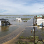
Hurricane Wilma was briefly the most intense Atlantic storm on record as it moved through the Caribbean toward the Gulf Coast. That was the last thing Gulf residents wanted to hear.
Two months earlier, Hurricane Katrina had killed 1,300 people and wreaked havoc across the region. So the pressure was on at the National Hurricane Center to get Wilma’s forecasts right. Its predictions were hailed as spot on during Katrina, but director Max Mayfield knew: “You’re only as good as your last forecast.”
Complex computer models doing trillions of calculations a second finally gave relief to Katrina’s victims on the Gulf Coast. They showed Wilma eventually making a sharp 90-degree right turn away from Louisiana and Mississippi and toward Florida. Hurricane Center forecasters were able to make that prediction one week before the storm finally hit Florida on Oct. 24.
“Five or 10 years ago, we never, never would have forecast something to re-curve like that,” Mayfield told the Gainesville Sun near the close of the busiest storm season on record. “That would have taken a lot of nerve in the old days to do that.”
The forecast improvements are largely due to better observations taken by researchers inside storms and the computer models run at the federal government’s Environmental Modeling Center, he said. Hurricane track and intensity predictions are in line to get even better when the center’s new model goes into use in 2007.
The advancements come at a time when some federal hurricane experts have argued that spending on hurricane programs is far lower than it should be, with many agencies lacking adequate staff and equipment.
Despite that, researchers are on the verge of making breakthroughs on matters that have puzzled experts for decades–predicting how strong and big a hurricane will become, said Frank Marks, who heads the Hurricane Research Division, which is part of the National Oceanic and Atmospheric Administration.
Next big step
The next big step will come in 2006, when the new Hurricane Weather Research and Forecast model will be run alongside others for final testing, said Naomi Surgi, the hurricane program leader at the Environmental Modeling Center. The HWRF will be used for public forecasts in 2007, she said. It should cut down even more on track errors, which have been reduced by half over the last decade, she said. Errors on 24-hour tracking forecasts are now on average about 50 miles off, down from 100.
What has researchers hopeful for intensity and size predictions is the HWRF’s ability to use more data in its calculations in real time.
The model’s higher resolution means it will use more readings of conditions from the land, sea and air to make better predictions. The current model created by the federal Geophysical Fluid Dynamics Laboratory uses readings taken 7.5 miles apart in a storm, but the new one shrinks that to as low as 5 miles.
Hurricane hunter aircraft also will feed live Doppler radar data to the model, which will allow it to make three-dimensional images of a storm’s structure. That will enable forecasters to see exactly where a hurricane’s worst winds and rains are in real time.
Once NOAA’s high-altitude jet gets the radar in 2008, it will be able to transmit radar images from the upper reaches of a hurricane down to near the surface, Surgi said. In several years, that may allow forecasters to predict how big a hurricane may be days in advance. That is just as important as judging how strong a hurricane will be, Marks said.
The HWRF will also have a component that will better represent what surface friction does to hurricanes. It should also give better predictions of hurricanes that stall in one place or have erratic tracks.
Was this article valuable?
Here are more articles you may enjoy.
 Hedge Funds Are Expanding Desks Designed to Profit From Natural-Catastrophe Risk
  AIG’s Turnaround Under Zaffino Sets Stage for New Leadership
  Georgia Brokers and Agents Alarmed After Court Ruling Expands Liability for Them
  South Carolina Jury Finds Store Owner Not Guilty of Murder in Shooting of Teen
 From This Issue