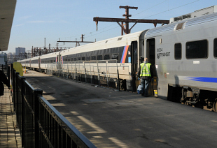

New Jersey Transit incorrectly used federal government software that otherwise could have warned officials against a disastrous decision to leave hundreds of millions of dollars worth of equipment in a low-lying rail yard before Superstorm Sandy struck, a Reuters examination has found.
The agency based its decision, at least in part, on software provided by the National Weather Service that allows users to simulate an approaching hurricane and show areas vulnerable to flooding from storm surge, according to Sandy-related forecast documents obtained by Reuters from New Jersey Transit.
Exactly how the agency used the software is unclear because the agency declined to answer any specific questions.

Reuters asked for the documents that New Jersey Transit relied upon in deciding to leave the trains at its Meadows Maintenance Complex in Kearny, New Jersey.
Among the documents was a screen-shot of storm prediction software that indicated the user had the storm traveling northeast, away from the New York area, while moving at the wrong speed.
As a result, the software predicted surges that were about half the levels actually forecast — errors that underestimated the threat to the Meadows complex.
New Jersey Transit takes issue with the findings. But a Reuters analysis shows that had the software been used to produce surge estimates similar to forecasts, agency leaders could have seen a different picture. The result would have pointed to potential inundation of a large portion of the rail yard, mirroring the flooding that ultimately occurred.
Other metro railroads in the region moved their rolling stock to rail lines and yards on higher ground.
National Weather Service meteorologists in two different offices with oversight of New Jersey agreed that the wrong settings were used.
“The way they were using it was guaranteed to underestimate storm surge,” said Gary Szatkowski, meteorologist-in-charge at the National Weather Service office in Mount Holly, New Jersey.
Reuters provided New Jersey Transit with its findings and asked a series of specific questions, such as how the software models factored into the agency’s decision to leave trains at the yard and whether officials were aware their models did not match the surge predictions from federal agencies.
John Durso Jr., a spokesman for New Jersey Transit, said in an email on Jan. 11 that the agency was reviewing the Reuters analysis, “but it’s fair to say that we will have some very serious, substantive disputes with your findings.”
Durso sent a statement two hours later that did not answer the specific questions. It said: “NJ Transit used the most current weather forecasts and available data at that time, along with accepted analysis practices by emergency management professionals and historical experiences, to inform and guide decisions up to and through Sandy.”
New Jersey Transit leaders have faced criticism over the decision since Reuters published an investigation in November that showed two federal agencies issued maps warning that rail yards in Kearny and Hoboken could flood.
The agency sustained $100 million in damage to one-third of its locomotives and a quarter of its passenger cars, and there were several weeks of service disruptions that caused long delays and crowded trains for New Jersey residents who work in New York City.
In testimony before New Jersey lawmakers last month, New Jersey Transit Executive Director James Weinstein said the rail yard decision was made based on “best available” weather forecasts.
“I can tell you unequivocally: The decisions on where to keep and move our rail cars and locomotives were sound, based on the best weather models and forecasts, historical experience and other information we had at the time,” Weinstein told members of the New Jersey General Assembly’s Transportation, Public Works and Independent Authorities Committee.
After that hearing, Reuters asked for the specific forecast documents. But the documents, released to Reuters under the New Jersey Open Public Records Act, show agency officials had warnings that Sandy could be different. Briefing slides from the National Weather Service used by transit officials warned of “major to record inland flooding along rivers and streams” and pleas to “plan for the worst and hope for the best.”
In a Saturday morning briefing, almost three days before the storm hit late on the night of Monday, Oct. 29, forecasters supplied a chart warning of a storm surge as high as 8 feet on the southern tip of Manhattan, a level that Szatkowski said should have been enough to “make the hair stand up on their necks.”
But the methodology used by New Jersey Transit officials with the federal government software predicted a surge of about 3 feet at The Battery in Lower Manhattan. The actual storm surge hit 9.23 feet at The Battery.
According to the documents, New Jersey Transit modeled a storm traveling northeast at 10 miles per hour.
Their inputs “severely underestimated the surge,” said Ross Dickman, meteorologist-in-charge at the National Weather Service office in New York City, in an email.
“The forecast all along was for a system to turn westward before approaching the N.J. coast, so I do not know where they would have gotten a NE movement from,” Dickman said.
A storm moving northeast would be heading away from New York and would have a substantially lower surge.
New Jersey Transit officials have been criticized by Dickman and Szatkowski for failing to contact their offices for advice as the storm approached. Dickman said the National Weather Service is “prepared to help or train any emergency manager” in the use of the modeling software.
“We certainly might have been able to help correct the inputs to their modeling if they contacted us,” Dickman said.