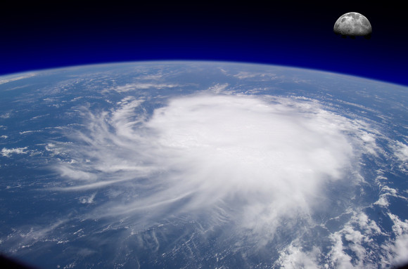
Superstorm Sandy set several records and was unusual in even more ways. Here are 12 strange weather features of Sandy:
1. Size: With tropical-storm-force winds that extended for 1,000 miles, Sandy was the largest Atlantic system on record. However, meteorologists only started recording this measurement for comparison in 1988.
2. Storm Surge: Sandy set historical maximum recorded water levels at the Battery in New York, Kings Point, N.Y.; Bergen Point, N.Y., Sandy Hook, N.J., Bridgeport, Conn., and New Haven Conn., according to the National Oceanic and Atmospheric Administration.
3. Snow: This is the first time the National Hurricane Center ever listed snow or blizzard in their warnings. Three feet of snow fell in West Virginia.
4. Great Lakes: It is unusual for 20-foot waves, large surges and tropical-force winds to be recorded in the Great Lakes for a coastal tropical storm, but it happened with Sandy.
5. Energy: NOAA’s Hurricane Research Division has an experimental program that measures integrated energy of a storm’s surge and waves on a 0 to 6.0 scale. Sandy reached 5.8, passing Katrina as the highest recorded so far.
6. Pressure: A more established measurement of storm strength is barometric pressure, with the lower the pressure the stronger the storm. Sandy hit a low pressure of 945.5 mb in Atlantic City, which some federal agencies called the lowest pressure recorded north of the Mason-Dixon line in the United States. The National Hurricane Center says the 1938 Great New England Hurricane, when reanalyzed, was slightly lower, but it was never recorded that low at the time.
7. Forecast: Computer models and forecasters saw Sandy coming for more than a week, even talking of a New York-area landfall — an unusually accurate forecast.
8. Turn West: It was the first time in modern recorded history that a storm took a sharp turn to the west and hit New Jersey. A scientific study said it was a once-in-700-years track.
9. Landfall Repeat: Sandy hit land in the very same town, Brigantine, N.J., as Irene did the year before (but Irene came from the south, a more common direction).
10. Fuel: For a while, Sandy was getting much of its fuel and power from the top of the system, which is more typical of a winter storm. Hurricanes tend to get their power from the warm water below.
11. Misplaced Winds: Sandy’s strongest winds at one point weren’t in its eye but 100 miles west of its center, which meteorologists said is quite strange.
12. Notable S-named Storm: This is only the second tropical system starting with an “S” to have its name retired, an indication of how unusual it is to have potent late season storms and how busy 2012 was for Atlantic storms.
Topics Hurricane
Was this article valuable?
Here are more articles you may enjoy.


 State Farm Adjuster’s Opinion Does Not Override Policy Exclusion in MS Sewage Backup
  Viewpoint: Runoff Specialists Have Evolved Into Key Strategic Partners for Insurers
  World’s Growing Civil Unrest Has an Insurance Sting
  Sompo Receives Regulatory Approvals to Acquire Aspen Insurance in $3.5B Deal

