
Officials in Wrightsville Beach, N.C., plan to challenge new federal flood plain maps in a move that could save some residents thousands of dollars in insurance premiums.
The StarNews of Wilmington reports the town’s board of aldermen agreed Sept. 10 to challenge the maps prepared by the Federal Emergency Management Agency.
The maps show that parts of the Harbor Island area are now at a high risk of flooding. But the town, working with a consulting firm from Charleston, South Carolina, contends that those areas should be classified as a lower risk.
An engineer told the board that the federal government used incomplete data in determining the flood risk and didn’t take into account things such as buildings and vegetation that can block flood waters.
Topics Flood North Carolina
Was this article valuable?
Here are more articles you may enjoy.
 JPMorgan Client Who Lost $50 Million Fortune Faces Court Setback
  North Carolina Adjuster and Son Charged With Embezzlement in Roof Jobs
 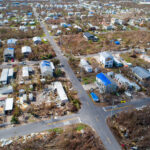 4,800 Claims Handled by Unlicensed Adjusters in Florida After Irma, Lawsuit Says