Utah is selling new maps that show the shaking intensity of earthquakes for the west half of Salt Lake County.
The set of 10 maps also spotlights the risks of landslides, rock falls, floods, radon gas and other hazards in the area.
The Utah State Geological Survey is selling a CD for $25 that contains a set of the maps and a 73-page report.
State geologists say the set will help guide development as population overtakes the west half of the Salt Lake basin.
The maps also spotlight the threat of collapsible or expansive soils, which can wreck buildings.
Copyright 2026 Associated Press. All rights reserved. This material may not be published, broadcast, rewritten or redistributed.
Topics Catastrophe Natural Disasters
Was this article valuable?
Here are more articles you may enjoy.
 Artist Suing FIFA Over Destruction of Dallas Whale Mural
 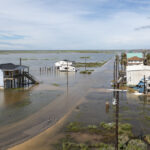 Hedge Funds Are Expanding Desks Designed to Profit From Natural-Catastrophe Risk
  AIG’s Turnaround Under Zaffino Sets Stage for New Leadership
  NY Lawmakers Agree to Governor’s Auto Insurance Reforms in New Budget
 From This Issue