
The U.S. Geological Survey is completing maps that will indicate earthquake hazards in the Evansville area.
Geophysicist Oliver Boyd tells the Evansville Courier & Press that he hopes the final maps will be ready next June. The agency will held a public presentation on the maps at the Evansville Central Library this week.
The maps are based on information collected by using a ground-penetrating sensor. They show areas where the soil is saturated with groundwater and may be liquefied by an earthquake. Those areas may be less likely to support large structures.
The maps also will show areas that are at risk from the shaking of the ground. A magnitude 5.2 earthquake struck the Midwest on April 18, 2008, causing only minor damage.
Topics Catastrophe Natural Disasters
Was this article valuable?
Here are more articles you may enjoy.
 MMA Alleges Broker Patriot Poached 11 Surety Team Members
 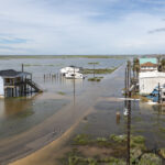 Hedge Funds Are Expanding Desks Designed to Profit From Natural-Catastrophe Risk
  Natural-Disaster Insurance Gap Now Exceeds $420 Billion Globally
  AIG’s Turnaround Under Zaffino Sets Stage for New Leadership