
A levee isn’t perfect, but it exists and that should count for something when deciding if a property is at risk for flooding.
That’s the position of the Federal Emergency Management Agency in a new proposal that would break from past policy by accounting for even deficient levees when drawing flood zones, calculating flood insurance rates, and requiring flood insurance purchases.
The proposal was released for public comment earlier this month and touches on part of the ongoing wrangling over the federally-subsidized National Flood Insurance Program: Should people who live behind levees be forced to buy flood insurance on the assumption that dikes and floodwalls might fail?
FEMA administrator Craig Fugate suspended rules earlier this year that gave no credit for deficient levees. Senators including Mississippi Republicans Thad Cochran and Roger Wicker, as well as Arkansas Democrat Mark Pryor and Illinois Democrat Dick Durbin, support the plan.
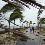
Hurricane Katrina in 2005 was a graphic illustration that levees can be overtopped or collapse. After that disaster, people began to realize what some had forgotten. Levees are a key part of flood protection all over the country.
FEMA treats an area protected by levees as if it wasn’t threatened by the body of water contained by the structure. But that’s only true if a levee is “certified,” meaning the U.S. Army Corps of Engineers or some other qualified engineer has concluded that there is less than a 1 percent chance in any year that a flood will break through or wash over a levee.
If the chances are greater than 1-in-100, FEMA has been calculating flood insurance rates as if the structure didn’t exist at all. Combined with more aggressive reviews of levees and redrawing of flood zones after Katrina, that means many communities nationwide had been facing higher flood insurance rates and restrictions on new development.
Many property owners, as a condition of their mortgages, would be forced to buy flood insurance for the first time. And they wouldn’t qualify for the relatively cheap premiums charged to people outside flood zones.
Authorities worry whether levees that protect downtown Dallas meet the standard. U.S. Sen. Jerry Moran, R-Kan., has introduced a bill that would suspend flood zone remapping for up to four years in a community that was working to improve levees.
A new flood map for Monroe County, Miss., was one of 242 nationwide that was put on hold by Fugate’s action. There, an earthen embankment along the Tennessee-Tombigbee Waterway provides some protection to communities such as Amory. The embankment, created when the Corps of Engineers dug out the waterway, was not designed as a levee and has never been certified. But Amory Mayor Howard Boozer said it’s ridiculous to say it provides no shelter from floods.
“It was an insult to most people’s intelligence in this area,” he said.
People in the region feared that not only would existing homes and businesses have to pay more, but that restrictions on building in the floodplain would stop industrial development along the Tenn-Tom. Greg Deakle, who leads economic development efforts in Itawamba County, to the north of Amory, noted that BlueFire Renewables is building a biofuel refinery in the floodplain, in part using grants from the U.S. Department of Energy. Deakle said that without relief from FEMA, that project could be in danger, because federal money can’t be spent to develop a flood zone.
The move could also mean relief for communities in the Midwest and South where last spring’s floods may have damaged levees.
“You can have 50 miles of levee in a system and if one foot has a deficiency, then the whole thing is deleted,” said Adam Telle, an aide to Cochran.
Mike Womack of the Mississippi Emergency Management Agency said that Yazoo City and other areas along the lower reaches of the Yazoo River will likely have their levees decertified. He said that federal and local communities are having trouble finding money to improve levees. The case along the Yazoo is further complicated by the fact that levees there are designed to be overtopped in a severe flood along the nearby Mississippi River, relieving pressure from the main Mississippi levees.
Waters came within a foot of overtopping the Yazoo levees in the spring 2011 floods, Womack said.
FEMA has proposed five different methods of trying to decide whether a levee should get partial credit, and local communities will have to provide data to help with the determination.
But even in cases where communities get relief, there’s still the question of whether people who live behind those levees are safe. A Senate version of a bill that would permanently reauthorize the National Flood Insurance Program would require anyone who lives in a floodplain, even behind a certified levee, to buy flood insurance. Such a move would increase the revenue of the program, which is trying to climb out of a deep hole created by payments after Katrina. But it also could mean less direct government aid after a levee collapse.
“If you’re behind a levee, it doesn’t mean you’re not going to flood,” said Womack, who supports the move. “It just means you have a reduced risk of flooding.”
Cochran, though, is against it. And the move is sure to be unpopular in places like Itawamba County. There, Deakle says it’s unfair to penalize people who bought what they believed was protected property.
“Why would people need to be forced to buy flood insurance for something that’s not their fault and they never thought would happen?” he asked.
Topics USA Flood Mississippi
Was this article valuable?
Here are more articles you may enjoy.
 Survey Shows Majority of Florida, California Homeowners Seeing Higher Insurance Costs
  Investment Funds File New Suits Over Lighthouse Insurance Collapse in 2022
  Allstate Reports $731M in Q1 Pretax Catastrophe Losses