
The odds are increasing that an El Nino weather system will form this year, portending drought for Australia and Asia and a warmer winter in the U.S. Northeast.
The U.S. Climate Prediction Center now says there’s a 65 percent chance the Pacific Ocean warming pattern will develop after August. It put the odds at 52 percent last month. The Australian Bureau of Meteorology, which expected neutral conditions at the start of the year, says the phenomenon may start as soon as July. The World Meteorological Organization of the United Nations sees an El Nino at midyear.
“We should know more clearly in a month exactly whether this is going to wimp out on us or if it’s really going to take off,” Kevin Trenberth, distinguished senior scientist in the climate analysis section of the National Center for Atmospheric Research in Boulder, Colorado, said in an April 14 interview. “The odds are pretty good that we are going to have a substantial event.”
In 1997-98, the strongest El Nino in records back to 1950 helped push the global mean temperature in 1998 up 1.2 degrees to what was then an all-time high of 58.1 degrees Fahrenheit (15 Celsius), according to a 1999 statement from the U.S. National Oceanic and Atmospheric Administration.
The agency estimated the U.S. economic cost at $10 billion, with crops wilting or drowning in the fields and consumers spending $2.2 billion less on heating fuels.
Global Damage
A 1982-83 El Nino was blamed for more than $8 billion in global damage, including flooding in South America, a hurricane in Hawaii and droughts or fires from Mexico to Australia, NOAA says. Almost 2,000 people died. An El Nino that developed in 2009 was considered a mild event, yet it created so much wind shear across the Atlantic Ocean that the hurricane season was the calmest in a decade, with nine named storms. Each of the next three years had 19 named systems.
A few degrees’ difference in temperature at the surface of the equatorial Pacific can alter the atmosphere in the skies above, creating a chain reaction of events that changes weather patterns globally. Less rain may fall in Australia, Japan and Korea. Winter may be wetter and cooler across the southern U.S. and milder from the Northern Plains to New England. The heat record set in 1998 was surpassed in 2005 and 2010, both years in which an El Nino event wound down.
An El Nino hasn’t formed yet. The warming of the ocean isn’t enough to trigger the phenomenon; there has to be a corresponding response from the atmosphere.
“It still has to properly get going,” Trenberth said.
Forecasting Accuracy
While the Pacific’s heat content last month surpassed 1997 levels, predictions made at this time of year have the least amount of accuracy, said Michelle L’Heureux, a climate scientist at the prediction center in College Park, Maryland. In 2012, forecasters said an El Nino was going to form, and it didn’t.
“In the May or June time frame, we start to become a little more confident of what’s happening,” L’Heureux said in an April 15 interview.
An El Nino this year would be the first since 2009-2010.
In Brazil, heavy rains brought on by an El Nino can cut the time available to harvest sugar and lower the sucrose content of the plants, Paul Bannister, head of sugar brokerage at Marex Spectron Group in London, said April 14 in an e-mailed report.
Disruptions associated with El Ninos have been most important for palm oil, cocoa, coffee and sugar, Goldman Sachs Group Inc. analysts including Jeffrey Currie wrote in an April 13 report. Sipef NV, a Belgian-based plantation operator, said in 1998 that its rubber production fell 4.6 percent a year earlier because of drought and forest fires in Indonesia.
The Economic Commission for Latin America said after the 1997-1998 El Nino that Ecuador would need years to recover from flooding that wiped out homes, roads, hospitals and schools.
Prediction Center
“If you are looking for a region of the planet that can have an influence on other regions of the planet, then the tropical Pacific wins hands down,” said L’Heureux. “The region over Indonesia, that area in particular, is just a huge driver of the global circulation. Changes there just cascade all over.”
Moist air rising over the heated ocean condenses and then falls as rain. Rainfall patterns in the tropics shift east and the Asian jet stream, while far to the north, tracks with the changes, L’Heureux said.
“That is why you ultimately get impacts over North America,” she said. “But you also get impacts over different tropical locations.”
Hurricane Killer
The Pacific phenomenon can cause winds that rip budding Atlantic hurricanes apart. The Gulf of Mexico, part of the Atlantic basin, is home to about 6 percent of U.S. natural gas production, 23 percent of oil output and more than 45 percent of refining capacity. Hurricanes Katrina and Rita, which hit the Gulf Coast weeks apart in 2005, sent gas futures to an intraday record of $15.78 per million British thermal units, compared with $7.90 a month before the storms struck.
Sea surface temperatures during the 2009-2010 El Nino peaked at 1.6 Celsius (2.9 Fahrenheit) above normal. Readings reached 2.4 degrees above normal during the 1997-1998 event, according to the climate center.
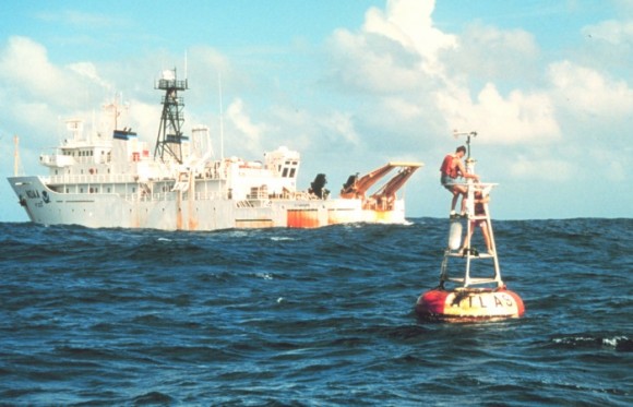
A large area of water that’s about 4 degrees Celsius warmer than normal has moved through the Pacific, the Australian Bureau of Meteorology said. This area, called a downwelling Kelvin Wave, has raised the surface of the Pacific about 6 inches (15 centimeters), another clue an El Nino may be forming, Trenberth said.
L’Heureax said there isn’t a one-to-one correlation between heat deep in the ocean, as in a Kelvin Wave, and what eventually makes its way to the surface. The high heat content has caught the notice of some commercial forecasters.
‘Fairly Bullish’
“We are fairly bullish here and think there is a 95 percent chance of at least a weak El Nino event developing in 2014, and a 65 percent chance of at least a moderate-strength event,” Todd Crawford, principal scientist at Weather Services International in Andover, Massachusetts, said in an April 15 e- mail interview. “There are many parallels between the upcoming event and the very strong 1997 event.”
Even if an El Nino does form this year, the effects may take months to develop, Michael Schlacter, chief meteorologist at Weather 2000 Inc. in New York, said in an April 15 interview. He said he thinks of El Ninos and the cooling patterns called La Ninas as “academic-year events,” meaning they most affect things after September.
“People are hearing there is an advisory and they are saying, ‘My goodness, I wonder if this changes the forecast for this weekend,'” Schlacter said. “It’s like turning a battleship. It’s very slow.”
–With assistance from Supunnabul Suwannakij in Bangkok, Ranjeetha Pakiam in Kuala Lumpur, William Bi in Beijing, Morgane Lapeyre and Alex Morales in London and Jake Lloyd-Smith in Singapore
Was this article valuable?
Here are more articles you may enjoy.
 Damaged Manhattan Tower Owner to Reconstruct 15 Floors After Evacuation
  20 Years After Hurricane Katrina: Are Insurers Ready for a Different $100B Disaster?
  Remember the Fall of Patriot National? Trial in Suit vs. Mariano’s Lawyers to Begin
  Robotaxi Riders Are Falling Asleep, Sparking Frantic 911 Calls