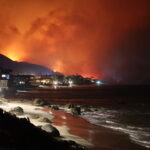
According to catastrophe modeling firm AIR Worldwide’s Dr. Tim Doggett, even though hurricane Jova has weakened to a tropical depression, it’s still capable of causing further damage. “Jova’s slow speed raises the potential for heavy rainfall accumulations—especially in the higher terrain to the right side of the storm track, including in Guadalajara, Mexico’s second most populous city and the capital of Jalisco” he explained.
“Indeed, given the high exposure concentration in Guadalajara, there is risk of notable flood loss from this event. Rainfall accumulations of 6-12 inches [15.2 to 30.5 cms] could be seen in the state of Jalisco, as well as in the states of Michoacán, Colima, and Nayarit. Isolated locations could experience accumulations as high as 20 inches [50.8 cms].”
According to AIR’s analysis, “Jova’s Category 2 winds at landfall could have caused considerable damage had they impacted a more densely populated location. Indeed, structural damage to non-engineered buildings may occur from Category 2 winds, particularly to roofs—while windows and the cladding on engineered structures could be damaged by impact from debris.”
AIR pointed out that most “insured residential structures on Mexico’s west coast—including those in Manzanillo and Puerto Vallarta—are made of confined masonry, which performs better than plain masonry under lateral wind loads because of its use of bond beams and columns. However, a large percentage of houses built every year in Mexico are constructed without a building permit, perhaps as large as 50 percent; these buildings are more prone to damage from wind. Commercial properties in this region, meanwhile, tend to be constructed of confined masonry or reinforced concrete.”
The report also noted that “although limited wind damage is expected to well-built structures at Jova’s observed wind speeds, the storm is expected to bring torrential rainfall; heavy rains are expected to persist well inland along the track and flooding and mudslides are a major concern.
“The damage picture from Jova is still emerging at this time, but the states of Jalisco, Colima and Nayarit are expected to be hit hardest. In the major port of Manzanillo, there have been reports of toppled trees, disrupted power lines and flooded streets. North of Manzanillo, flooding from storm surge remains possible along a 210-mile [336 kms] stretch of Mexico’s coast.”
Dr. Doggett commented: “Hurricane Jova’s general movement to the north is forecast to continue as it moves inland today—on a track that will take the storm over western Mexico today and tonight. It is expected to weaken and ultimately dissipate within 24 hours. At present, Jova remains a consolidated system with a well-defined and tight center. Heavy rain is the primary concern.”
AIR added that in 1959 “an unnamed hurricane made landfall in the same area where Hurricane Jova came ashore yesterday, destroying about 40 percent of all homes in Manzanillo. The 1959 hurricane made landfall as a Category 5 storm, however, while Hurricane Jova was a Category 2 storm. Additionally, Hurricane Jova currently was a rather small storm, with hurricane-force winds relatively confined to the center of the eye.”
AIR added that it is “gathering the available meteorological information on this event and once the storm has run its course, AIR will determine if a loss estimate is warranted.”
Source: AIR Worldwide
Topics Catastrophe Flood Hurricane Mexico
Was this article valuable?
Here are more articles you may enjoy.


 Travelers to Expand Homeowners Insurance Offering in California
  State Farm Paid a ‘Hail’ of a Lot of Claims in 2025
  Chubb Q1 Net Income Increases 74% on Fewer Catastrophe Losses
  Study Finds ‘Alarming’ High Flood Risk for 17M Americans on Atlantic, Gulf Coasts

