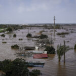
According to catastrophe modeling firm AIR Worldwide, Typhoon Chan-hom is “steadily intensifying as it passes over warmer-than-average ocean water.” The storm also remains on track to make land fall on Saturday “in heavily populated southeastern China, near Wenzhou in Zhejiang prefecture.” It may also “make a glancing landfall on Taiwan as it passes between that island and Okinawa.”
AIR senior scientist Dr. Kevin Hill commented: “Typhoon Chan-hom drenched the U.S. territories of Guam and Rota with up to a foot of rain when it crossed them during the July 4 weekend. The storm entered the Philippine Area of Responsibility (PAR) on Tuesday (where it is known as Typhoon Falcon) and is expected to leave PAR Friday.”
According to the Japan Meteorological Agency (JMA), Typhoon Chan-hom’s central pressure was 965 mb and maximum 10-minute sustained wind speeds were 70 knots (93 mph 1-minute sustained). “During the past 24 hours, Chan-hom has maintained a good overall structure, including a ragged eye. Deep convection is favored on the southern side of the eye and has been somewhat restricted to the north, limiting intensification to this point. Chan-hom is located within a favorable environment for intensification, with relatively low wind shear and warm sea surface temperatures (SSTs).”
Dr. Hill added: “Chan-hom has generally been tracking west-northwest around the southwestern periphery of the subtropical ridge, and this track is expected to continue for the next 72 hours. Conditions appear favorable for intensification, with JMA forecasting maximum 10-minute sustained wind speeds of 85 knots (112 mph 1-minute sustained) along with a central pressure of 940 mb prior to landfall (valid at 12:00 UTC July 10).
“The Joint Typhoon Warning Center (JTWC) is more aggressive with its intensity forecast, with maximum 1-minute sustained wind speeds reaching 120 knots (138 mph) at 06:00 UTC July 10. Just prior to landfall, there is the possibility of some weakening due to cooler SSTs and reduced oceanic heat content.”
AIR also indicated that according to the JMA’s forecast track, “Chan-hom will graze northern Taiwan prior to making landfall in China near Wenzhou in Zhejiang prefecture. After landfall, Chan-hom is predicted to track through Zhejiang and begin to curve poleward as the subtropical ridge responsible for the northwest track retreats to the east; on this track, the remnants of Chan-hom could produce heavy rainfall in Shanghai. There is still uncertainty regarding the exact timing of this recurvature, and it is possible that Shanghai could face a more direct hit if recurvature occurs slightly earlier than currently forecast.”
Chan-hom is one of three active tropical systems in the Pacific basin, with Tropical Storm Linfa to its west and Typhoon Nangka to its east.
AIR’s report on Linfa noted that it “made a relatively uneventful landfall in the mountainous Philippine island of Luzon Sunday morning (local time), July 5, and is forecast to track westward and make landfall in China in Guangdong prefecture as a strong tropical storm. AIR does not currently expect significant damage from Linfa.”
AIR also said “Typhoon Nangka will be an active system for a long period of time, as it is forecast to move very slowly on a generally northwestward track. Long-range models, including the Global Forecast System (GFS), indicate the potential for a landfall in Japan in 9-10 days, although the model spread in forecast track and intensity is large, leading to uncertainty in the long-range forecast. AIR will provide updates on Nangka as the situation warrants.”
Dr. Hill noted, “This highly active period of tropical systems follows a fairly significant lull in activity, during which no named storms formed in the one-month period between Typhoon Dolphin’s dissipation on May 21 and Tropical Storm Kujira’s formation on June 21.”
AIR explained that the “2015 Western Pacific typhoon season is off to a very active start. Typhoon Nangka, the 11th named storm, formed on July 3; since 1980, only six seasons have had the 11th named storm form in the month of July, with the earliest being July 20 in 2002. Since 1951, only one season has featured an earlier formation of the 11th named storm—1971—when Typhoon Gilda formed on June 24; that year the 13th named storm formed on July 5.”
Dr. Hill concluded: “While the Typhoon Chan-hom storm track and landfall location remain in question, Chan-hom has the potential for delivering a damaging blow to coastal urban areas of southeastern China, especially if accompanied by a high storm surge. In particular, authorities in China are concerned about Shanghai, a low-lying city of 14 million. Much of Shanghai is less than 10 feet above sea level, so flooding from storm surge and heavy rains are a significant concern.”
According to AIR, with high population density along the southeast coast of China,” many homes and businesses are at risk. Houses and apartment buildings in coastal regions of southeastern China are commonly constructed from confined masonry or reinforced concrete, with clay tile roofs.
“Commercial and industrial structures are also largely of reinforced concrete, but older structures are of unreinforced masonry and some confined masonry. Confined masonry and reinforced concrete structures perform reasonably well in the face of typhoon winds, but damage from flooding from storm surge and/or precipitation is a major concern.”
Source: AIR Worldwide.
Topics Catastrophe Natural Disasters China
Was this article valuable?
Here are more articles you may enjoy.


 Judge Awards Applied Systems Preliminary Injunction Against Comulate
  Portugal Deadly Floods Force Evacuations, Collapse Main Highway
  How One Fla. Insurance Agent Allegedly Used Another’s License to Swipe Commissions
  ‘Structural Shift’ Occurring in California Surplus Lines

