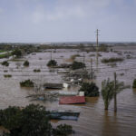
Officials Harvey County, Iowa, say some residents may need to buy flood insurance under new federal maps of the area’s flood plain.
Scott Davies, director of the Harvey County Planning and Zoning, says 270 residents of unincorporated areas may be in the flood plain under new maps from the Federal Emergency Management Agency maps.
The Newton Kansan reports that the maps don’t take affect until Oct 6. Davies says homeowners placed in the flood plain need to buy flood insurance.
Davies says some people living in the city of Newton would be removed from the flood plain because of dams have been built in the Sand Creek Watershed the last flood maps were adopted in 1983.
Bob Franke, a civil engineer for FEMA, says the new maps used findings from private surveyors and data from the U.S. Geological Survey.
Information from: The Newton Kansan, http://www.thekansan.com
Was this article valuable?
Here are more articles you may enjoy.


 Judge Awards Applied Systems Preliminary Injunction Against Comulate
  BMW Recalls Hundreds of Thousands of Cars Over Fire Risk
  Experian Launches Insurance Marketplace App on ChatGPT
  Portugal Deadly Floods Force Evacuations, Collapse Main Highway

