
New federal maps show that fewer buildings in Dubuque, Iowa, are at risk of flooding.
The Dubuque Telegraph Herald reports that the Federal Emergency Management Agency recently updated flood insurance maps for the area that were last changed in 2011. The new maps remove more than 40 buildings from areas where flood insurance is required.
The current flood insurance rate maps list 236 structures in the 100-year flood plain.
Assistant City Planner Wally Wernimont says the new maps are based on more accurate information. They will be used to help guide development plans in the area.
Copyright 2026 Associated Press. All rights reserved. This material may not be published, broadcast, rewritten or redistributed.
Topics Flood
Was this article valuable?
Here are more articles you may enjoy.
 Farmers to Pay $2.8M to Settle TPCA Class Action Lawsuit
  Ranking: Who Are the Insurance Industry’s AI Talent, Maturity Leaders?
  Clash of Florida Titans Pits Powerful Tribe Against Homebuilder Lennar
 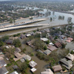 20 Years After Hurricane Katrina: Are Insurers Ready for a Different $100B Disaster?