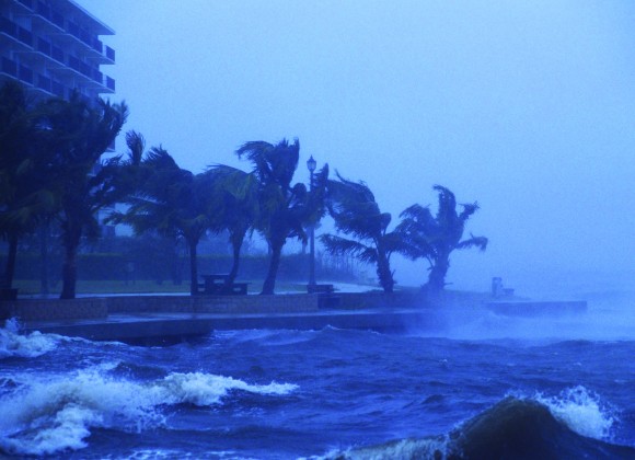
As the people of New Orleans, New Jersey and New York know all too well, much of the death and damage caused by hurricanes isn’t from the wind. It’s from the storm surge.
When the 2015 Atlantic hurricane season starts June 1, people living along the coast of the U.S. mainland are going to get a new set of alerts from the National Hurricane Center in Miami.
In addition to tropical storm and hurricane warning and watches, the center will post storm surge alerts for any location where water might rise at least 3 feet (91 centimeters) above normal, said Jamie Rhome, team leader of the center’s Storm Surge Unit.
“Roughly 50 percent of the lives lost” to tropical weather “are because of storm surge,” Rhome said in an interview Monday at the National Hurricane Conference in Austin, Texas.
More than 1,500 people died when Hurricane Katrina hit Louisiana in 2005, and many of those deaths were attributed to surge up to 19 feet high in the New Orleans area, according to the center. In Sandy, surge overtopped Manhattan’s Battery and sent seawater into subways, cellars and tunnels, blacking out parts of the island. Surge destroyed homes and businesses from Queens to the New Jersey coast as the destructive storm swept ashore.
Surge Severity
Storm surge is a wall of water a tropical storm or hurricane can push onto the shoreline. Its severity depends on such things as the storm’s size, strength, forward motion and the lay of the land.
When a tropical system nears the Atlantic coast this season, the hurricane center will issue surge watches 48 hours in advance and warnings 36 hours before the cyclone makes landfall. Those criteria are the same as those used for the storms themselves.
The major difference is that the hurricane and tropical storm watches and warnings are mainly advisories about a system’s wind, Rhome said.
The wind determines a hurricane’s strength on the five-step Saffir-Simpson scale. For instance, when sustained winds reach 74 miles (119 kilometers) per hour, a tropical storm becomes a Category 1 hurricane.
No Scale
Rhome said storm surge was removed from the Saffir-Simpson scale in 2009 “because it didn’t work.” The new alerts are in addition to surge maps the hurricane center introduced last year. There won’t be a separate scale created for surge.
“We already have a scale for storm surge — it’s called ‘feet,'” Rhome said. “People can visualize water.”
If a scale were created, people would have to look up the magnitude of the threat on a chart. By simply expressing it in terms of feet, people will know if the surge is going to be over their heads or over their houses.
The warnings and watches will appear on this season’s maps as purple areas, Rhome said. Darker purple will be for warnings, while a lighter shade will be for watches.
The advisories may cover different areas than those warning against the wind because surge charts its own destructive course.
“Surge and wind don’t go hand in hand,” Rhome said.
Experimental Phase
After this year, officials at the center will evaluate the program and make changes. The current season is an experimental phase.
That doesn’t mean the warnings and watches should be ignored.
“There is still actionable information in these,” Rhome said. “It’s meant to be a message of life-threatening conditions.”
The criteria of 3 feet could change next year, or how the messages are conveyed to the public. Rhome said work is also being done to roll the program out to Puerto Rico, the U.S. Virgin Islands and Hawaii, which are all susceptible to hurricanes and tropical storms.
In addition, Mexico is studying the U.S. forecast models for the possibility of coming up with a program there, and work is under way for a demonstration product in Hispaniola, which would cover Haiti and the Dominican Republic.
Charting the impacts of storm surge is complicated because the topography of the seashore is always changing, through both human development and natural forces. Every year, the coastline has to be inspected and the models predicting surge need to be updated, Rhome said.
The take-away from all of this is simple: If you see your neighborhood shaded in purple on a hurricane center map, it’s time to move to higher ground.
Topics USA Catastrophe Natural Disasters Windstorm Hurricane
Was this article valuable?
Here are more articles you may enjoy.


 Some College Finals Delayed After Canvas Online Platform Hacked
  Travelers: Aging Workforce, New Employees Drive Complexity in Injury Claims
  Lawyers, Traders Among 30 Charged in Global Insider Trading Case
  South Florida Police Officers Sue Actors, Say Details in ‘The Rip’ Are Too Real

