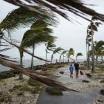
A computer modeling system has been developed by two university researchers to predict the annual damage done by hurricanes, based on wind patterns over the land and sea in July, to predict whether damages will be greater or less than average in the August to October storm season.
“This will be really important for insurance companies,” David Simmons, a risk consultant for Benfield, a London-based reinsurance company said. “When faced with the possibility of a catastrophic event, insurers need to decide whether they will buy more coverage or not. The authors claim that over time, insurers could save 30 percent on their returns and premiums using this model.”
Mark Saunders and Adam Lea of University College London’s Benfield Hazard Research Centre in Dorking, UK, have extended previous work to form robust predictions of the financial damage in a hurricane season. Using their model on past years, they could say whether a year would see damages that were above or below average in 74 percent of cases, they report in Nature.
“This offers the potential to significantly reduce the financial risk and uncertainty associated with the hurricane season,” Saunders explained.
Saunders said they had a chance to do so last year, when a devastating sequence of four hurricanes cost insurance firms billions. The researchers used an early version of their model to forecast a worse-than-average season.
“If they had used our forecast they could have saved themselves money,” Saunders claimed.
They said their new computer model accurately predicted the chaos of 2004 — when Florida absorbed serial attacks by Hurricanes Charley, Frances, Ivan and Jeanne.
Moreover, looking over history in what they called “hindcasts,” their technique correctly predicted below-average or above-average hurricane-related insurance losses — one measure of the frequency and power of land-falling storms — during 74 percent of the years between 1950 and 2003, they said.
The team garnered data about winds in the troposphere, which extends about 10 kilometers up from the surface of the Earth, from 1950 to 2003. From these they identified persistent wind systems, dubbed ‘steering winds’, in six key regions. Together, these winds seem to determine whether the coming season will be a bad one for U.S. residents. Near Bermuda, for example, unusually high pressures in July can cause onshore winds that consistently blow towards the U.S. coast for the remainder of the summer.
Hurricane systems tend to form in the tropical North Atlantic before drifting westwards, Saunders explains. If they encounter a steering wind pointing away from the coast they will swerve harmlessly back out to the ocean. But if the steering winds are pointing towards land, the storms are funneled onto the shore.
The researchers are not sure why the steering winds remain consistent for the entire summer. “There’s lots of day-to-day variation,” Saunders said. “But overall the winds do seem to persist for around three months.”
Topics Catastrophe Natural Disasters Hurricane Education Universities
Was this article valuable?
Here are more articles you may enjoy.


 Are ‘Moderate’ Hurricanes Getting Squeezed Out of the Atlantic?
  Study Finds ‘Alarming’ High Flood Risk for 17M Americans on Atlantic, Gulf Coasts
  Hedge Fund Money Is Reshaping a 180-Year-Old Insurance Model
  California Insurance Commissioner Race Has Diverse Field Amid ‘Insurance Crisis’

