
New Jersey’s Congressional delegation members sent a letter to the Federal Emergency Management Agency (FEMA) on Oct. 23, expressing “significant concerns with the methodology” of the Flood Insurance Rate Maps (FIRMs) for New Jersey.
In a letter to FEMA Administrator Craig Fugate, the lawmakers said the evidence suggests that several core flaws may have exaggerated the flood risk across New Jersey, resulting in higher insurance premiums. They urged FEMA to take measures to ensure that the maps are scientifically accurate in order to represent the true risk to communities and individual property owners.
The letter was signed by U.S. Sens. Robert Menendez and Cory Booker (D-N.J.) and Reps. Chris Smith (R-4th Dist.), Frank Pallone (D-6th Dist.), Rodney Frelinghuysen (R-11th Dist.), Frank LoBiondo (R-2nd Dist.) Bill Pascrell (D-9th Dist.), Albio Sires (D-8th Dist.), Leonard Lance (R-7th Dist.), Donald Payne, Jr. (D-10th Dist.), Donald Norcross (D-1st Dist.), Bonnie Watson Coleman (D-12th Dist.) and Tom MacArthur (R-3rd Dist.).
“Being placed in a greater risk zone results in higher and sometimes unaffordable insurance premiums, reduction in property values, and costly retrofitting. With the consequences of FIRMs being so broad and far-reaching, it is critically important that these maps be objective and accurate,” the lawmakers said in a letter to Fugate.
The legislators said dozens of New Jersey municipalities, organizations and individuals are appealing the latest FEMA maps.
“We have received letters from multiple boroughs, organizations and individual homeowners who cannot afford the dramatic increases in insurance premiums associated with the FIRMs—increases that appear to go well beyond the risk,” they wrote. “In some cases, individuals will simply no longer be able to afford their homes or businesses—while at the same time, they may be unable to sell them with such high premiums.”
“As several appellants have already demonstrated, fundamental methodological errors—including, but not limited to, inadequacies in validation and deficient tidal effects—have resulted in erroneous estimates of the 1 percent Flood Risk elevation by several feet. This difference has enormous implications for tens of thousands of New Jersey homeowners and small businesses,” New Jersey’s Congressional delegation members said.
In response, FEMA spokesman Rafael Lemaitre said the federal agency used the best available science and technical data to create the Flood Insurance Rate Maps. “These maps aren’t created in a vacuum. We work closely with community officials, residents and other stakeholders to make sure everyone has input and is included in this process,” he said in a statement.
The following is the full text of the letter:
October 23, 2015
The Honorable Craig Fugate
Administrator
Federal Emergency Management Agency
500 C Street S.W.
Washington, D.C. 20472
Dear Administrator Fugate:
We are writing to express our significant concerns with the methodology FEMA is using to modify Flood Insurance Rate Maps (FIRMs) for New Jersey. As several appellants have already demonstrated, fundamental methodological errors—including, but not limited to, inadequacies in validation and deficient tidal effects—have resulted in erroneous estimates of the 1% Flood Risk elevation by several feet. This difference has enormous implications for tens of thousands of New Jersey homeowners and small businesses.
As you know, FIRMs are an important tool developed to quantify flood risk all around the country. They are used, not only to determine flood insurance premiums, but also to guide building codes and mitigation activities. Subsequently, these determinations have significant real world consequences for families and business owners. Being placed in a greater risk zone results in higher and sometimes unaffordable insurance premiums, reduction in property values, and costly retrofitting. With the consequences of FIRMs being so broad and far-reaching, it is critically important that these maps be objective and accurate.
To date, dozens of New Jersey municipalities have appealed their preliminary FIRMs as currently drafted. Analysis from Jersey City, for example, shows that FEMA has overestimated properties in the Special Flood Hazard Area (SFHA) by as much as 34 percent, unnecessarily putting approximately 28,000 Jersey City residents in the SFHA at a potential cost of millions of dollars. Similarly, the City of Elizabeth predicts that the inaccurate expansions of SFHAs will begin “driving residents from their homes,” especially in older communities, while the City of Newark expects a devastating effect centered on its vital Ironbound community, potentially depleting this important tax base. Additionally, we understand that the City of New York has appealed their preliminary FIRM based on what they believe to be fundamental flaws in FEMA’s methodology. As FEMA evaluates the appeal, we ask that you consider the impact that potentially flawed methodology would have on the preliminary FIRMs for communities throughout all of New Jersey.
We have received letters from multiple boroughs, organizations and individual homeowners who cannot afford the dramatic increases in insurance premiums associated with the FIRMs—increases that appear to go well beyond the risk. In some cases, individuals will simply no longer be able to afford their homes or businesses—while at the same time, they may be unable to sell them with such high premiums.
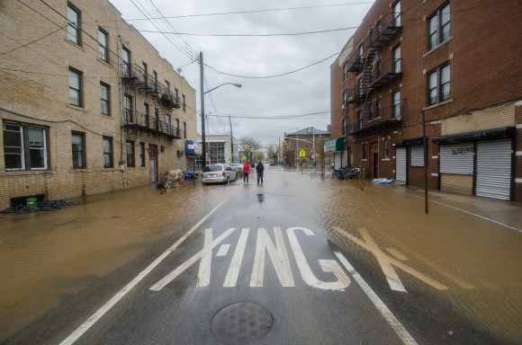
With the memory of the devastation caused by Superstorm Sandy fresh in our minds, we along with our fellow New Jerseyans are more than cognizant of the need for accurate flood maps to identify risk and steer rebuilding in a more resilient manner. We understand and take flooding very seriously. However, including more homes and neighborhoods into SFHAs than necessary adversely affects families and, more broadly, calls into question the credibility of the FIRMs. In order to justify full compliance with the NFIP, FIRMs and flood insurance rates must reflect the most accurate predictions that technology affords.
The evidence laid out in a number of appeals suggests that several core flaws may have exaggerated the flood risk across New Jersey, resulting in insurance premiums that are neither sustainable nor reflective of the most accurate science. We strongly urge you to ensure all communities have the technical assistance and resources to exercise their right to appeal, and act with all expedience to resolve these discrepancies so New Jerseyans have access to reliable, objective, and accurate flood risk information.
Topics Legislation Flood Homeowners New Jersey FEMA
Was this article valuable?
Here are more articles you may enjoy.
 Insurance Broker Stocks Sink as AI App Sparks Disruption Fears
  Two-Thirds of Independent Agencies Plan to Increase AI Use This Year, Survey Says
  Sompo Receives Regulatory Approvals to Acquire Aspen Insurance in $3.5B Deal
  Florida Regulators Crack the Whip on Auto Warranty Firm, Fake Certificates of Insurance