

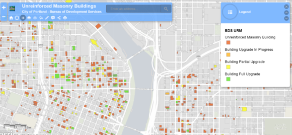
Portland, Ore., officials have released a map and database showing about 1,800 unreinforced masonry buildings that may be vulnerable to shaking during an earthquake if they are not structurally retrofitted.
These buildings were generally constructed before the 1960s using brick with little to no steel reinforcement in the walls.
The building data was collected as part of a Portland seismic retrofit project.
The project is being led by the Portland Bureau of Development Services, the Portland Bureau of Emergency Management and the Portland Development Commission.
The groups are working with community members to reduce the risk posed by these buildings.
Since the last time Portland collected data about unreinforced masonry buildings, roughly 13 percent of those structures were fully or partially upgraded and another 8 percent were demolished.
The interactive map enables users to punch in an address, share the information on social media for via email, measure distances or get GPS coordinates.
Was this article valuable?
Here are more articles you may enjoy.
 How One Hacker Used AI Agents, a Few Thousand Dollars to Break Into Websites
  Home Insurance Tops Property Taxes in Squeeze for US Households
  Insurer Rolls Out Policy to Protect Data Centers Against Growing Backlash
  Viewpoint: Beware These Commercial Auto Endorsements!
 From This Issue