On Nov. 28, the California Department of Conservation released Seismic Hazard Zone maps used to plan for safer buildings to help protect life and property in the event of an earthquake. The maps detail four areas-Thousand Oaks, Moorpark, Ontario and Mt. Baldy-that are susceptible to the secondary earthquake hazards of landslides and liquefaction. With the release of these official maps, property sellers must disclose to buyers if the property is in a state-mapped seismic hazard zone.
Was this article valuable?
Here are more articles you may enjoy.
 US to Explore Allowing Driverless Cars Without Steering Wheels
  Remember the Fall of Patriot National? Trial in Suit vs. Mariano’s Lawyers to Begin
  Hellman & Friedman’s Hub International Seeks $3 Billion in IPO
 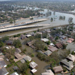 20 Years After Hurricane Katrina: Are Insurers Ready for a Different $100B Disaster?
 From This Issue