
Catastrophe modeling firm AIR Worldwide is currently tracking Typhoon Muifa as it moves across the Pacific Ocean towards mainland China, after delivering heavy rain to the Philippines Tuesday and Wednesday. Muifa is forecast to make landfall south of Shanghai this weekend, bringing high winds and heavy rains.
According to the Japan Meteorological Agency’s (JMA) 18:45 UTC advisory, Muifa’s maximum ten-minute sustained winds are 157 km/hr (97 mph), classifying it as a weak Category 2 storm. Its maximum gusts are higher, at 203 km/h (127 mph), and the storm’s radius of tropical storm force winds extends for about 220 kilometers [137.5 miles]. As of 8:00 am local time this morning, meteorological authorities in China’s eastern province of Zhejiang said the storm was roughly 1,000 kms [625 miles] southeast of the province’s capital, Fuzhou.
According to AIR, as it continues on its northwestward track, Muifa is expected to weaken despite very high sea surface temperatures. Weakening will come from increased environmental wind shear over the Yellow Sea, the northern part of the East China Sea.
Though all agencies have Muifa making landfall south of Shanghai, differences in the forecast tracks do exist; the JTWC forecast track is the farthest north and the JMA forecast track is among the farthest south. Depending on the exact track, landfall will occur sometime during the day on Sunday, August 7, probably in the afternoon (local time).
After landfall, Muifa is expected to follow a more northward trajectory and eventually move offshore, north of Shanghai, back over the Yellow Sea and towards North Korea. The storm center will likely stay close enough to the China coast to maintain a good moisture supply; thus, despite the weakening of the winds up to and after landfall, Muifa could generate a significant amount of precipitation.
Over the last 24 hours, it has been generating estimated peak rainfall amounts around 300 millimeters [app 12 inches]. These amounts could increase as Muifa approaches warmer coastal waters and significant terrain—which serves to enhance rainfall—along China’s coast.
As the typhoon approaches, an orange alert for high waves has been issued in the East China Sea. According to China’s National Marine Environmental Forecasting Center, the eastern part of the East China Sea could experience waves as high as six to nine meters. Muifa is likely to bring heavy rains and high winds to major growing areas of the north China plains and southern Manchuria, putting crops at risk.
Earlier this week, Muifa battered parts of the northern and central Philippines with heavy rains, displacing more than 14,000 households. Muifa’s heavy rains enhanced rainfall already present from the regional monsoon.
According to AIR, the majority of residential buildings in China “are masonry, with unreinforced masonry still found in older buildings, particularly in rural areas. Most urban dwellers, by contrast, live in mid-rise or high-rise apartment buildings. Mid-rise buildings are often confined masonry while high-rises tend to be reinforced concrete.
“When exposed to lateral wind loads, confined masonry performs better than unreinforced masonry due to the additional stability provided by the bond beams and columns. Concrete is more resistant to wind loads as well as flood damage than all types of masonry. Due to the superior materials and building practices, wind damage to apartment buildings is typically restricted to non-structural components, such as windows and balconies. The majority of commercial structures in China are concrete and masonry construction. Commercial and industrial buildings are generally more resistant to wind and water damage than residential buildings.”
AIR added that Muifa’s track and intensity “bear similarities to those of Typhoon Winnie, which brought heavy rain and damage across eastern China in 1997—a Category 3 storm at landfall. Muifa was upgraded to tropical storm strength on July 28th, having formed five days earlier. It was briefly a strong Category 4 typhoon, though it could not maintain this strength. It weakened on July 31, and has weakened further since.”
AIR is continuing to monitor all developments in the northwest Pacific basin and will provide updates as warranted by events.
Source: AIR Worldwide
Topics Catastrophe Natural Disasters China
Was this article valuable?
Here are more articles you may enjoy.
 Majority of Small Business Are Underinsured as Other Expenses Prioritized
  FDA Says It’s Investigating Another Cyclospora Parasite Outbreak
  Jury Awards 78-Year-Old Victim $56 Million for Crash Caused by Amazon Delivery Driver
 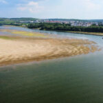 Record-Low Danube Water Levels Leave Boats Beached, Reveal Decades-Old Shipwrecks