
A European Union satellite mapping agency says 104 square kilometers (40 square miles) of land was burned northeast of Athens this week during a deadly wildfire that gutted scores of homes and prompted multiple countries to send assistance.
The Copernicus Emergency Management Service announced the damage estimate Wednesday, a day after the wildfire was contained in a massive effort that ended on the outskirts of the capital.
A factory worker was killed in the fire that swept through mountainous areas southward, covering an area almost twice the size of Manhattan and blanketing the Greek capital with a thick cloud of smoke.
The fire damaged 22 businesses and rendered at least 78 homes uninhabitable, with nearly half of them completely destroyed, Greek officials said Wednesday. Inspections in fire-afflicted areas will continue in coming days.
Nine countries, including neighbor Turkey, sent assistance to Greece to boost ground crews and water-dropping planes and helicopters operating outside Athens.
The wildfire follows successive heat waves across southern Europe and low levels of rainfall this year.
According to an updated estimate by the National Observatory of Athens, over the past eight years 450 square kilometers (174 square miles) of forest have been burned in the Attica region that includes Athens. That amounts to 37% of the region’s total forested area.
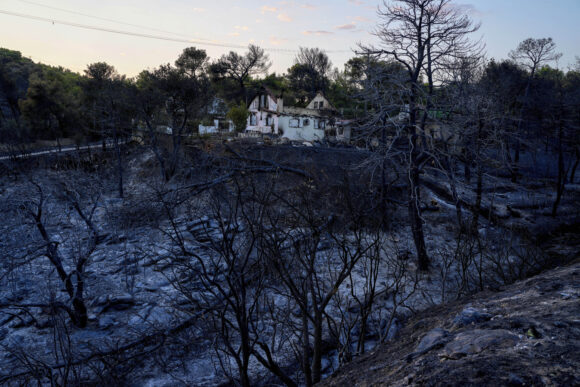
Photograph: A damaged house is seen in Penteli, a suburb of Athens, Wednesday, Aug. 14, 2024, following a deadly wildfire near the Greek capital. (AP Photo/Petros Giannakouris)
Topics Catastrophe Natural Disasters Wildfire
Was this article valuable?
Here are more articles you may enjoy.
 Damaged Manhattan Tower Owner to Reconstruct 15 Floors After Evacuation
  Clash of Florida Titans Pits Powerful Tribe Against Homebuilder Lennar
  Honda’s Insurance Agency Operations Stall, Services ‘Paused’
  US P/C Industry Books Best Result in a Decade but Not All Lines Enjoy Success