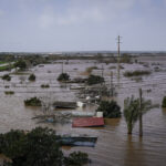
An estimated 340 Maui properties could be affected by plans by federal officials to revise maps of flood-prone areas.
Such a change could force flood insurance rates to increase substantially.
Carol Tyau-Beam, Hawaii coordinator for the National Flood Insurance Program, says premiums could rise from $1,300 to $6,000 a year. She says property owners should consider buying insurance before the new maps become effective next October 2009.
The last revision of flood maps in the county occurred in 1981.
The areas of most concern are Waikapu Stream, Iao Stream and the South Maui areas of Kamaole Gulch and Kaluaihakiki Stream.
An informational meeting on the revision is set for 3 p.m. Thursday, Dec. 11, 2009, at the Velma McWayne Santos Community Center in Wailuku, Hawaii.
Topics Flood
Was this article valuable?
Here are more articles you may enjoy.


 Florida Insurance Costs 14.5% Lower Than Without Reforms, Report Finds
  Insurify Starts App With ChatGPT to Allow Consumers to Shop for Insurance
  BMW Recalls Hundreds of Thousands of Cars Over Fire Risk
  Portugal Deadly Floods Force Evacuations, Collapse Main Highway

