
It’s the statistical peak of Atlantic hurricane season, and there isn’t a storm in sight — for now.
September’s second week is usually when the season gets into full swing, as warm ocean waters fuel dangerous winds and coastal communities from Central America to Canada brace for nature’s fury. Pre-season outlooks called for more than the average 14 storms to form between June and the end of November.
So far, though, those forecasts appear to be too aggressive. There have been six storms in the Atlantic powerful enough to receive names and only one of them – Erin – reached hurricane strength. Typically, eight storms and three hurricanes would have taken shape by this time of year. AccuWeather Inc. said Thursday that it now sees as many as 16 storms this season, down from its original prediction of up to 18.
Still, late-season systems can unleash widespread devastation. After a lull in early September last year, Hurricane Helene formed toward the end of the month, followed closely behind by Hurricane Milton. The two storms killed at least 277 people in the US and caused $113 billion in losses and damages across the US.
“There are definitely times in a hurricane season when you have two- or three-week periods of nothing,” said Eric Blake, a senior hurricane specialist at the US National Hurricane Center. “Last year is a decent example. It was extremely busy later in the season.”
Related: Warm Gulf Water Could Fuel Storm Intensification in September
Water temperatures are reaching record highs across the Gulf of Mexico, amplifying the risk of rapid intensification — the phenomenon of storms growing quickly in strength — if systems develop there, according to AccuWeather. Warm water extends deep, meaning the storms will have a reservoir of fuel.
“The exceptional warmth in the Gulf is troubling,” Alex DaSilva, a meteorologist with AccuWeather, said in a statement.
In the near term, though, dry air has combined with unfavorable wind conditions, a lack of thunderstorms and the slowdown of fast-flowing air currents in the upper atmosphere to “put significant breaks on the Atlantic hurricane season,” said Phil Klotzbach, lead author of Colorado State University’s seasonal storm forecast.
As to “where the hurricanes have gone, I think the answer is the same as the Facebook relationship status option, ‘It’s complicated,'” Klotzbach said.

The last year when there wasn’t a storm somewhere in the ocean between Sept. 8 and Sept. 14 was 1992, according to hurricane center records.
“Not only are there no named storms, there aren’t even disturbances worth monitoring — which is unprecedented over the last couple of decades,” said Ryan Truchelut, a meteorologist at commercial forecaster WeatherTiger.
But the season has more than 11 weeks left before it officially ends on November 30. Later in that period, storms tend to form closer to North America. The last hurricane to slam into the US at Category 5, the highest level on the Saffir-Simpson scale, was Michael in October 2018.
“There is still a huge risk for land areas as you go through the latter half of September and October and November,” Blake said. “It is way too early to make vast pronouncements.”
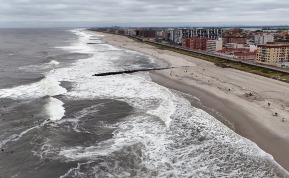
Top Photo: Waves following Hurricane Erin in Long Beach, New York on Aug. 21. (Bruce Bennett/Getty Images)
Was this article valuable?
Here are more articles you may enjoy.
 As Parasite Spawned Chaos, Taylor Farms Slow-Walked Response
  Husband and Wife Insurance Brokers Sentenced for Fraud Scheme
  US P/C Industry Books Best Result in a Decade but Not All Lines Enjoy Success