
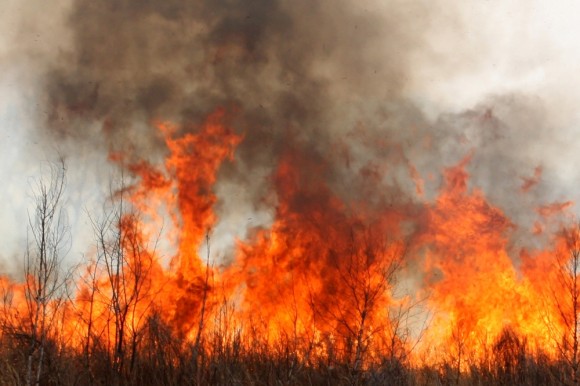
When Tom Larsen thinks of the Dixie Fire in Northern California, he thinks about better modeling.
Larsen, the senior director for content strategy for catastrophe modeler CoreLogic Inc., pointed to some grim facts about the ongoing Dixie blaze: It’s already the second largest wildfire in recorded state history, and over the past two years five of the state’s top seven largest fires have occurred – things he blames on forestry management, climate change, more homes being built in the wildland-urban interface and of course the massive drought plaguing the Western U.S.
“What we’re seeing now in the last few years is loss history’s insufficient,” Larsen said. “The history that we’ve seen is insufficient to look forward and understand the risk.”
The Dixie Fire has burned 489,287 acres, and is only 21% contained, according to CalFire. The fire covers areas including Butte, Lassen, Plumas, Tehama counties.
Evacuation orders include the west shore of Lake Almanor from the Canyon Dam, northwest to Hwy 36 at Hwy 89. This includes the communities of Prattville, Big Meadows, and Lake Almanor West along with the Rocky Point Campground and the Canyon Dam Boat Launch.
Some 30,943 residents have been evacuated, the total number of structures impacted is estimated at 843, and things could get worse, according to Yassy Wilkins, a CaldFire public information officer, who pointed to a recent shift in winds. “We’re experiencing winds coming from the southwest and they have gusts up to 25 mph,” Wilkins said.
There are 5,813 personnel battling the blaze, including 525 engines, 135 water tenders, and 30 helicopters.
Larsen is encouraged by the massive response, but he believes the focus should also be on continuing to develop models to better understand forward-looking risk, and figuring out better ways to “de-risk our communities.”
“It’s more confirmation that a risk model is necessary for us to really understand this risk,” he said.
Insurers recently have been forking over big bucks to try and better understand the potential impact of California wildfires.
California regulators in June approved a plan by Farmers Insurance to assess wildfire risk by using a tool that combines artificial intelligence with high-resolution aerial photography. The carrier said the Z-Fire risk scoring model developed by Zesty.ai is expected to make standard coverage available to an additional 30,000 homeowners.
Beside working to better model their risk, insurers have also began to pull back and write less in wildfire prone areas.
Homeowners in California’s high-risk areas are finding it difficult to obtain property insurance outside of the California FAIR plan. The number of California homeowner policies that insurers declined to renew rose 31% to 235,250 in 2019 from 179,458 in 2018, while the number of policies issued through the FAIR plan rose to 190,196 from 140,138, according to a report by the California Department of Insurance.
California Insurance Commissioner Ricardo Lara began calling for incentives to mitigate. In May, he asked property insurers in the state to step up and do more to help residents and businesses deal with wildfires. He said eight insurers and the California FAIR Plan offer discounts to harden homes and take mitigation steps to reduce wildfire risks, which only represents 13% of the overall state market.
Larsen also noted in recent housing data from Census that the area affected by the Dixie Fire has outpaced housing growth statewide, growing at 2-3% in the past year.
“It’s a disproportionate growth of housing stock in these riskiest areas,” Larsen said. “It’s imperative that we do a better job of protecting them.”
Related:
Topics California
Was this article valuable?
Here are more articles you may enjoy.
 Two Years in, Ortiz Steps Down as CEO of Florida Re
  Insurers Must Defend Hotels Accused of Sex Trafficking of Minors
  US P/C Industry Books Best Result in a Decade but Not All Lines Enjoy Success
  FDA Walks Back Positive Lab Test in Lettuce Cyclospora Outbreak