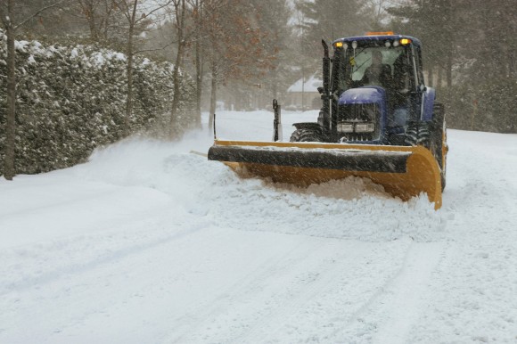
The worst storm of the winter season has knocked out power to thousands and canceled almost 3,000 flights. Next it threatens to bring more snow, ice and cold from Florida to Nova Scotia, including New York and Boston.
Winter storm warnings and advisories stretch from Maine to South Carolina, including New York, where as much as 8 inches (20 centimeters) may fall Thursday, the National Weather Service said. A blizzard warning has been issued for Boston, which could get 13 inches of snow and has closed schools Thursday.
Blizzard conditions are also possible along much of New England’s coastline, eastern Long Island and parts of New Jersey, Delaware, Virginia and North Carolina. The city of Philadelphia declared a snow emergency.
Staten Island and Queens also face a flood threat between 9 a.m. and noon Thursday as the storm will push tides as much as 12 to 18 inches higher than normal, said Faye Morrone, a weather service meteorologist in Upton, New York.
“It could result in some flooding, especially for vulnerable locations on the shoreline,” Morrone said.
Snow has already fallen in Tallahassee, Florida’s capital, said Rob Carolan, a meteorologist and president of Hometown Forecast Services Inc. in Nashua, New Hampshire. Snow was reported in Savannah, Georgia, while freezing rain and ice covered broad areas of southern states.
“We are going to get a decent snowfall out of this,” said Carolan, referring to New England. “The bad news is it will ruin tomorrow morning’s commute.”
The weather stands to wreak havoc on markets for longer, as electricity prices already surged to the highest level in years and natural gas demand hit a record high. As of 7 p.m. on the East Coast, about 29,000 customers were without power from Maryland to Florida, according to data compiled by Bloomberg from utility websites.
Airlines had canceled more than 2,100 Thursday flights so far, on top of 558 Wednesday, according to FlightAware, an online tracking service. American Airlines Group Inc. and Delta Air Lines Inc. have begun suspending flights at some eastern U.S. airports.
Governors of states in the path of the storm have declared emergencies.
The storm’s focus and track will shift north until it brings its worst to Boston and coastal New England Thursday. Wind gusts along the coast from Maine to Massachusetts could reach 70 miles (113 kilometers) an hour in places Thursday with heavy snow.
“The real apex, the peak of the storm, will be Cape Cod to Nova Scotia,” said Gregg Gallina, a forecaster at the U.S. Weather Prediction Center in College Park, Maryland.
Snow Bomb
This storm may end up being worse than your average nor’easter. It could turn into a bomb, short for bombogenesis, a phenomenon that occurs when a system’s central pressure drops steeply — 24 millibars or more — in 24 hours.
The lifeblood of a bombing storm is a harsh gradient between cold and warm temperatures. This sharp divide was on display early Wednesday as temperatures in Charleston, South Carolina, hovered around 29 degrees, while a buoy offshore recorded readings of 51.4 for the air and 71.1 for the ocean.
“That is a key driver, the cold air mass and the warm Gulf Stream,” Gallina said. “Cold air battling warm air.”
The atmosphere doesn’t like imbalance, Carolan said. When it happens the results can be ferocious.
If current computer models hold, that’ll start to happen somewhere off Cape Hatteras, North Carolina, and continue as the storm moves north. Hurricane-force wind warnings have been posted off the coast where ships could encounter winds of 80 miles an hour and waves as high as 26 feet on Thursday.
“It is certainly going to be a bomb,” Carolan said. “It could drop 40 to 50 millibars in 36 hours.”
The high winds generated by the storm could cause widespread power outages to go along with blizzard conditions. Morrone said gusts of 40 to 50 miles an hour could sweep parts of New York, especially southern Queens.
Environment Canada has issued its own warnings for New Brunswick and Nova Scotia, including Halifax.
Gallina said as the storm pulls off into the Atlantic, another blast of very cold air is going to roar down from the north behind it and spread out across the central and eastern U.S.
“There is a lot of potential for records being broken Friday and Saturday,” Gallina said.
Was this article valuable?
Here are more articles you may enjoy.


 No, Florida Lawmakers Did Not Repeal the No-Fault Auto Insurance Law
  Brown & Brown Wins Temporary Injunction Against Howden
  Specialty Insurance Rates Soften Faster Than Expected, Hitting 2020 Price Levels: WTW
  Hedge Funds Make Their Move as Litigation Finance Assets Slump

